History
20 Ancient Maps That Still Puzzle Historians
Some maps weren’t made to help travelers—they were drawn to make sense of the world. Ancient cartographers mixed myth, memory, and mystery, leaving behind questions we still can’t answer. The farther we zoom in, the more the lines between fact and imagination start to blur with these maps.
Piri Reis Map
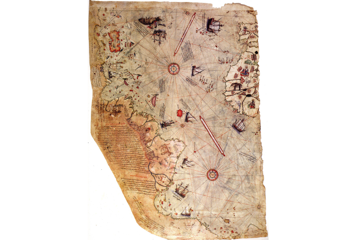
A fragment of a larger map, this Renaissance-era piece appears to show Antarctica centuries before its official discovery. Ottoman admiral Piri Reis claimed he compiled it from older sources. If true, what knowledge shaped his understanding of the frozen land?
Vinland Map
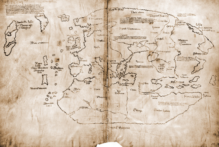
Believed to confirm Norse exploration in North America before Columbus, the chart ignited debate when Yale revealed it in 1965. Some claim it’s authentic; others call it a clever hoax. Although the ink does point to a forgery, something still seems wrong.
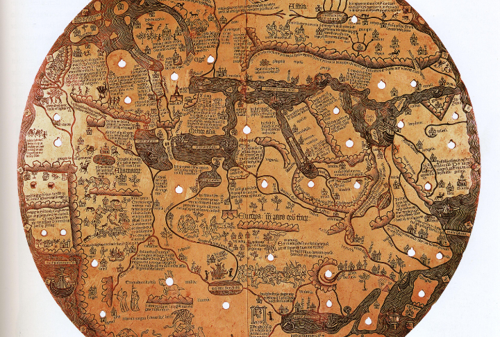
Ebstorf Map
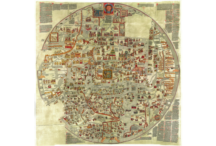
This enormous circular map was drawn onto 12 sheets of parchment until it was destroyed during World War II air strikes. Unlike other medieval maps, it goes beyond geography to fuse theology and history into a single, intricate portrayal of the known realm.
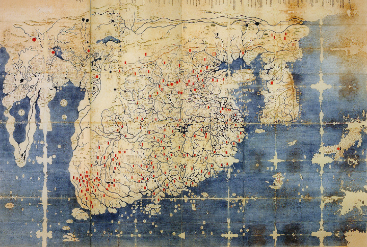
Da Ming Hun Yi Tu
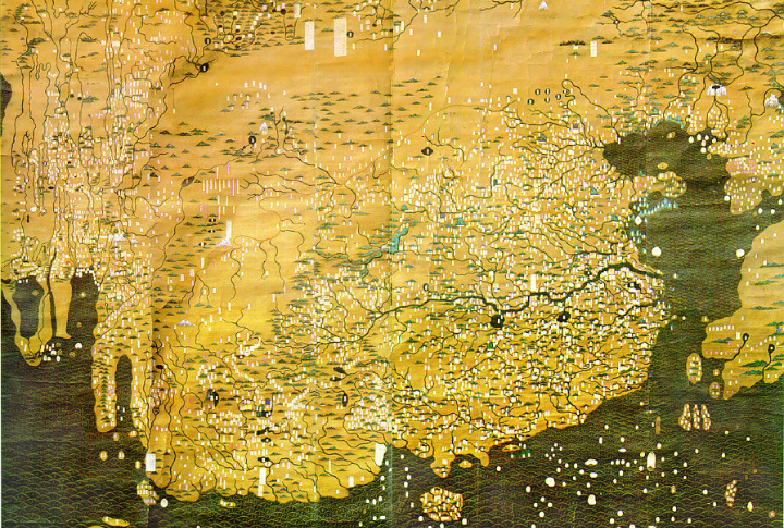
A vast map from the Ming Dynasty exhibits Africa and Europe with a precision that wouldn’t have been possible in 14th-century China. Whether based on direct exploration or second-hand knowledge, the accuracy of the map continues to challenge historical assumptions.
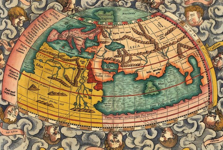
Ptolemy’s Geographia Maps
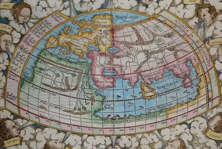
Claudius Ptolemy introduced the idea of mapping the world using coordinates long before GPS was even a dream. Some of his guesses hit surprisingly close to reality, while others missed the mark completely. When his work resurfaced during the Renaissance, it even helped inspire explorers to sail further.
Cantino Planisphere
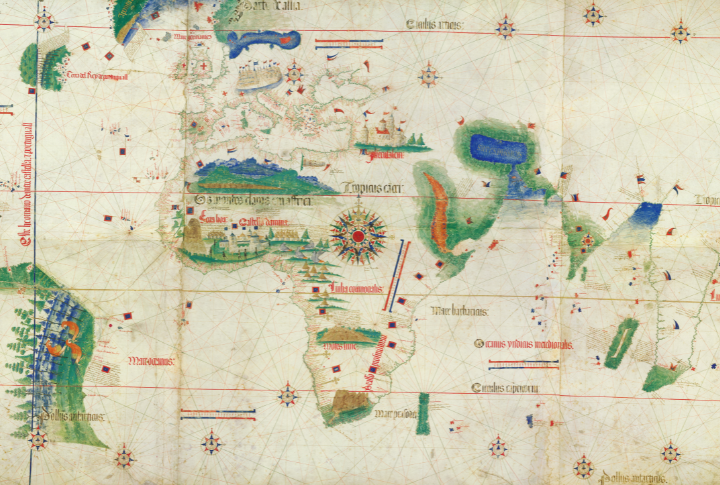
Smuggled from Portugal to Italy in a barrel of meat, the map shows the American continents with remarkable accuracy, strikingly advanced for its time. Many suspect it reveals Portuguese discoveries that were deliberately kept secret, adding another layer of mystery to early voyages.
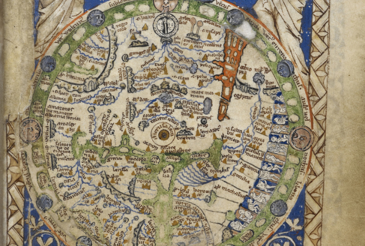
Mappa Mundi
Drawn around 1300 on stretched calfskin, this isn’t just a map—it’s a medieval worldview. Jerusalem is at the center, with heaven and hell depicted, while monsters lurk along the edges. Faith and geography blur here, which raises the question: Were these creatures symbolic or real?
Zeno Map
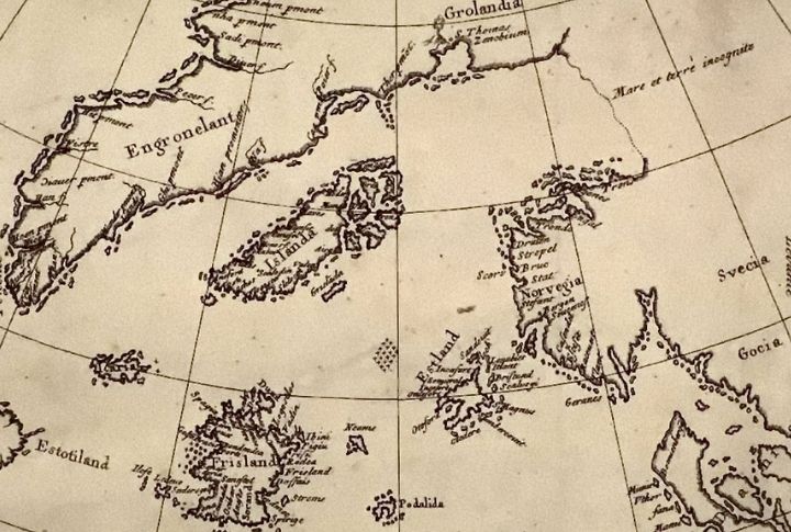
The Zeno map includes mysterious islands like Estotiland and Drogeo that seem nonexistent. Either the Zeno brothers found lands lost to history or exaggerated their journey. Regardless, their account fueled explorers for generations and inspired the search for places that may never have existed.
Kangnido Map
Long before European explorers mapped Africa and India, Korean cartographers had already done it. This chart challenges assumptions about how the world was illustrated in the early 15th Century. Plus, the level of detail suggests access to remarkable sources far beyond their own borders.
Nuzhat al-Mushtaq
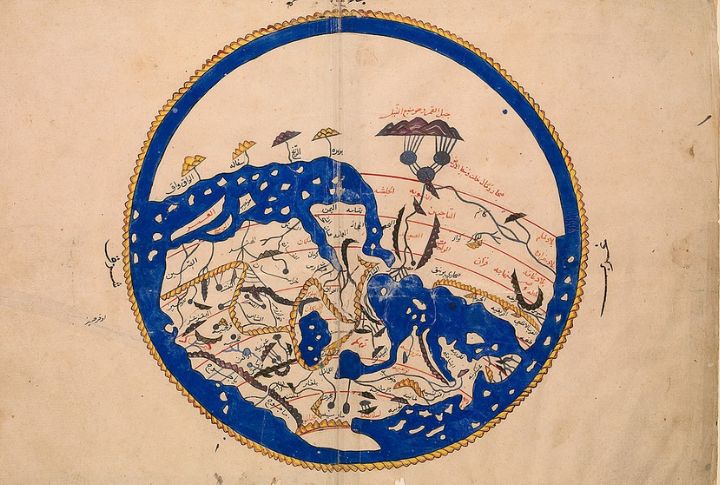
Drawn for a Norman king of Sicily, this Arabic-language map flipped the Earth’s layout upside-down—south at the top, Europe at the bottom. Despite its odd perspective, it was one of the most accurate charts of its time. Al-Idrisi compiled it using traveler accounts and scholarly texts.
Babylonian World Map
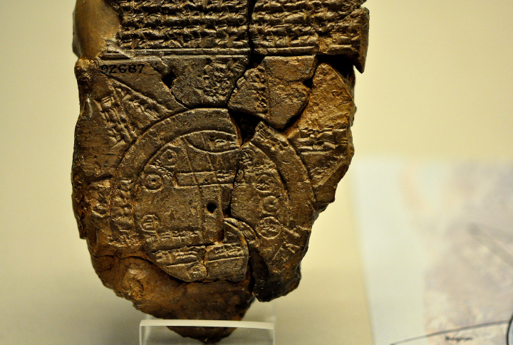
Babylon takes center stage on an ancient clay tablet, with the known world sketched around it and an outer ocean circling it all. Some names match real geography, others don’t—but it clearly reflects how early Mesopotamians saw themselves in relation to everything else.
Yuchi Map
The goal wasn’t to match the world’s shape. It was to organize it symbolically. The placement of cities, deities, and cosmic elements reflects a worldview where administration and belief were tightly linked, especially in Japan’s early imperial context.
Psalter Map
Tiny enough to fit inside a prayer book, this map places Jerusalem at the center and the rest of the world in the margins. It emphasizes devotion over travel and reflects medieval priorities rather than serving as a practical reference for movement.
Catalan Atlas
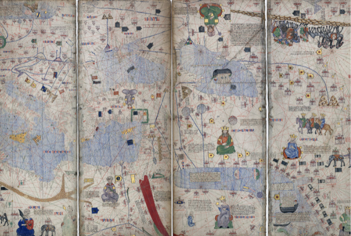
The Catalan Atlas is a historical masterpiece where geography meets storytelling. It showcases golden camels and crowned kings, with a sea teeming with ships. Blending discovery with speculation, the drawing raises a timeless question: Were ancient sources based on true voyages or creative storytelling?
Beatus Maps
Created to illustrate the Apocalypse, these medieval portrayals of the Earth are rich with fantastical elements. Some depict mountains as divine barriers and rivers as celestial pathways. Though not geographically accurate, they make us wonder how monks with no exploration records envisioned the world so boldly.
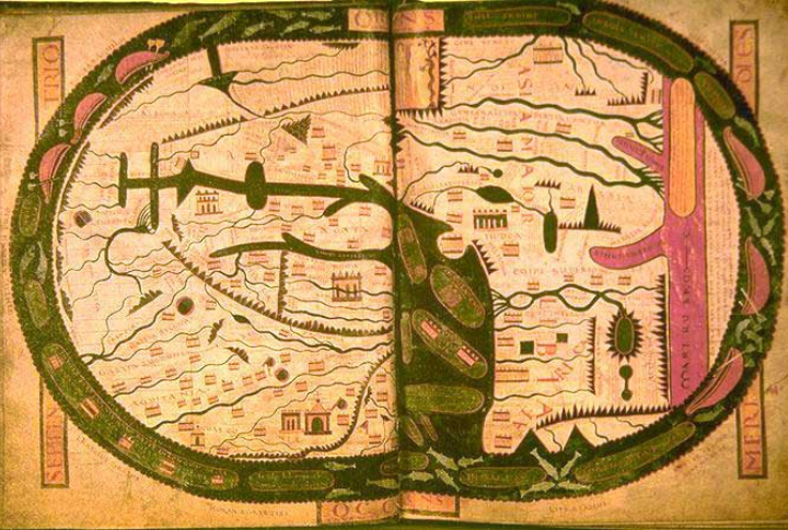
T And O Map
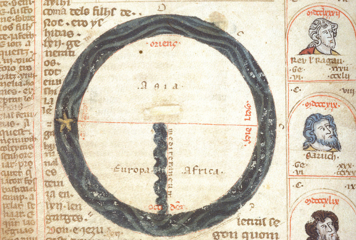
Structured as a symbolic representation rather than a functional model, the design shows the known lands as a circle split into three sections, with Asia dominating the upper half. Navigation wasn’t the goal here. Its real impact was on how people in the Middle Ages understood their place in a divine order.
Tabula Peutingeriana
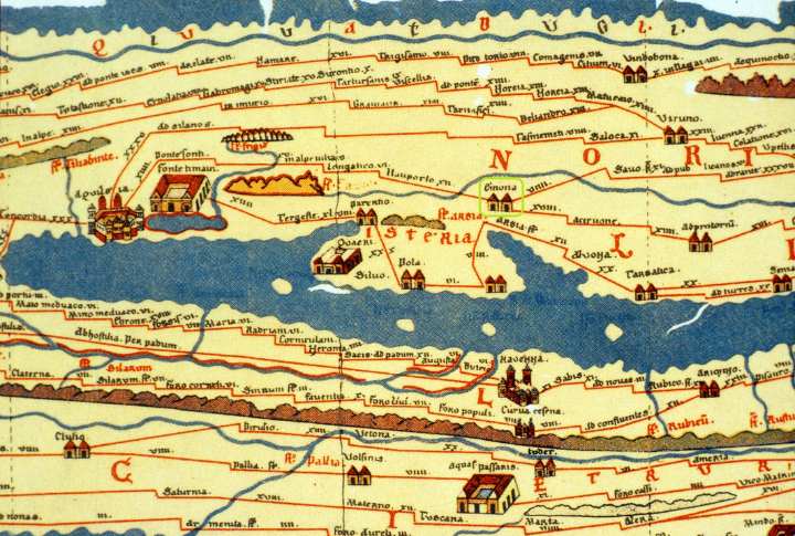
Just imagine a subway map of the Roman Empire. This 22-foot-long scroll stretches from Britain to India, depicting roads rather than terrain. It’s incredibly useful for tracing ancient routes, yet oddly distorted, which gives it a fascinating glimpse into how Romans saw their world!
Fra Mauro Map
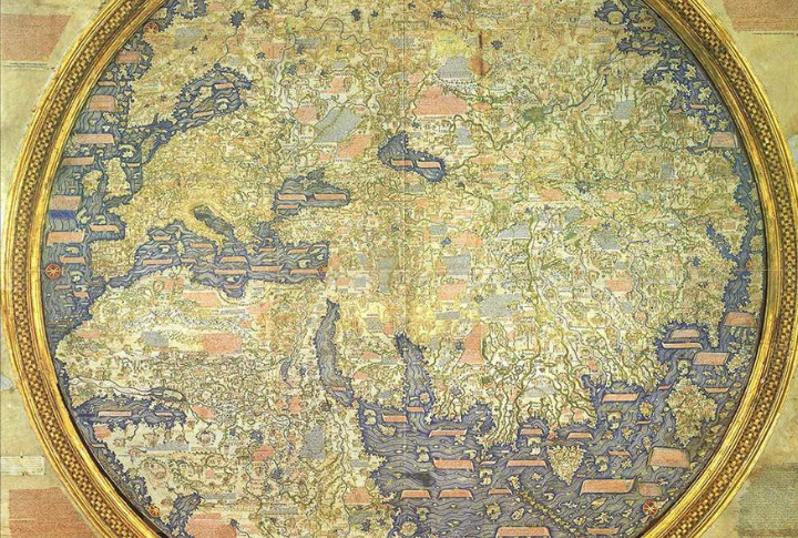
A Venetian monk crafted the masterpiece with an unexpected twist. He reversed traditional mapping and placed south at the top. It also suggests Africa could probably have been fully explored long before Europeans officially did it. Maybe he was guessing, or maybe he knew more than we realized!
Turin Map Of Gold Mines
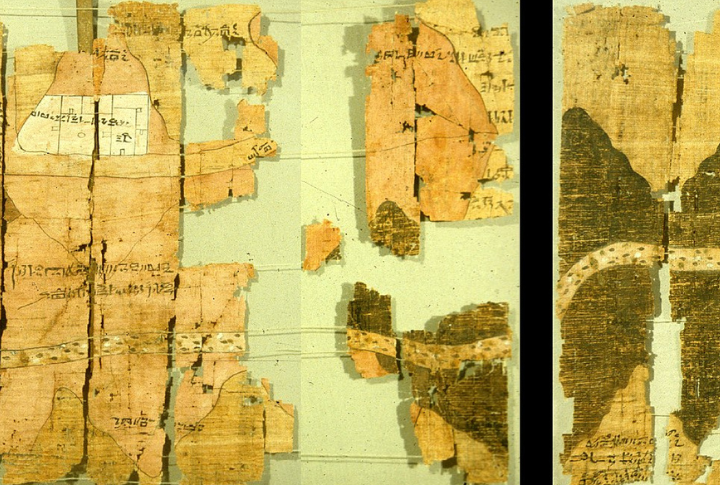
This papyrus doesn’t show continents or oceans, but it does something equally valuable. It charts gold mines in Nubia. Detailed markings suggest a functional purpose, yet the unusual orientation raises questions. Was it a simple mining reference, or did it hold deeper significance?
Borgia Map
An eerie mix of geography and prophecy, the depiction places Eden in Asia and surrounds the land with fantastical creatures. Whether created as a genuine attempt at mapping or meant as a theological statement, its true purpose remains unknown, which adds to its enduring mystery.