History
20 Geographical Facts About The U.S. That’ll Blow Your Mind
You might think you’ve got the U.S. all figured out—stars, stripes, burgers, and big old maps. But beneath that patriotic sparkle lies a set of surprises that geography teachers probably forgot to mention. So, here are 20 facts that will make you see the U.S. with stunned eyes.
Alaska Spans Both Easternmost And Westernmost Points
Semisopochnoi Island in Alaska crosses the 180th meridian, making Alaska both the easternmost and westernmost U.S. state. This tiny, remote island lies in the Eastern Hemisphere. No other state stretches this far across longitudes, which makes it an odd twist in geography that only maps can explain.
Mauna Kea Surpasses Everest In Total Height
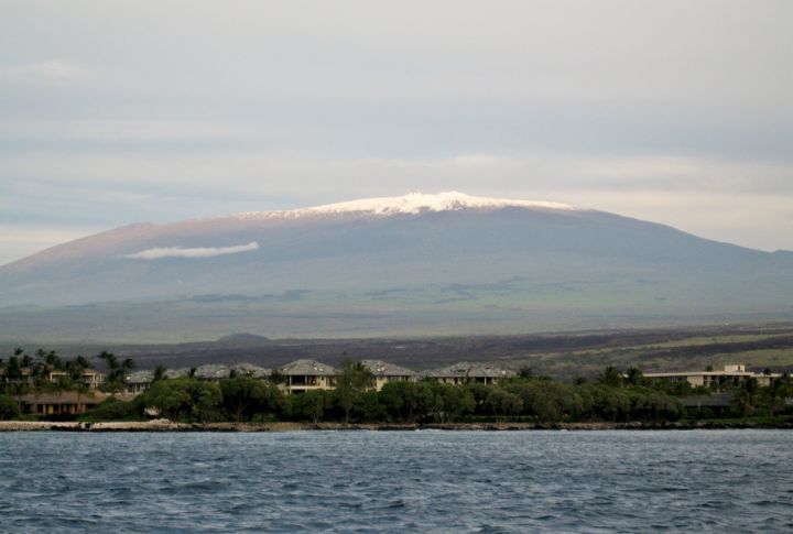
Measured from base to its summit, Mauna Kea in Hawaii beats Everest. Rising over 33,500 feet from the ocean floor, only 13,800 feet emerge above sea level. This dormant volcano stuns geologists with its bulk, and divers love the submerged slopes.
Two Ocean Creek Divides Into Atlantic And Pacific Watersheds
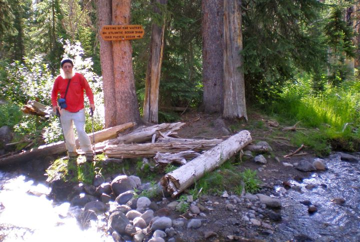
Near Yellowstone National Park, Two Ocean Creek forks at the Parting of the Waters. One half flows to the Pacific, the other to the Atlantic. You can stand with a foot in each future ocean. It’s the kind of spot where raindrops argue about vacation plans.
Death Valley And Mount Whitney Are Close Elevation Extremes
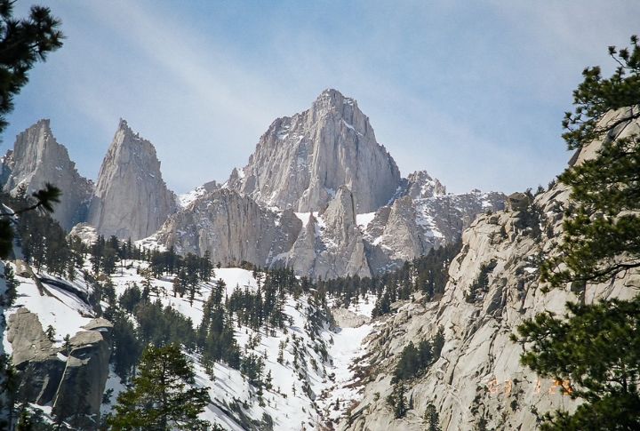
California consists of the highest and lowest points in the contiguous U.S. which are just 85 miles apart. Mount Whitney stands tall at 14,505 feet; Death Valley sinks to almost 282 feet below sea level. Hence, within hours, you could hike alpine trails and stroll salt flats.
Maine Lies Closer To Africa Than Florida
Despite popular belief, the point closest to Africa isn’t in sun-soaked Florida. It’s Quoddy Head, Maine. That jagged northeastern tip angles eastward, which is enough to shorten the Atlantic’s span to Morocco. Interestingly, sailors once favored this unexpected shortcut.
Alaska Has The Longest U.S. Coastline
Alaska claims over 33,000 miles of coastline, the most of any U.S. state by far. This massive total includes mainland shores, island edges, bays, and intricate fjords. Plus, the state borders the Arctic Ocean, Bering Sea, and Pacific Ocean, giving it unmatched geographical and ecological diversity.
Mount Washington Holds Record Wind Speeds
In 1934, Mount Washington, New Hampshire, clocked a wild 231 mph gust. That wind speed rivaled a Category 5 hurricane, and observers had to crawl outside to avoid being lifted off the ground. Even today, it’s dubbed the “Home of the World’s Worst Weather.”
Trona Pinnacles Resemble Alien Terrains
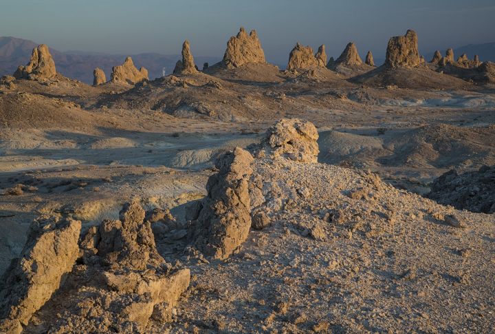
Hidden in California’s desert basin, the Trona Pinnacles rise like fossilized coral castles. These calcium carbonate towers formed when ancient Lake Searles evaporated, leaving behind over 500 spires. Bonus: their unearthly shapes have doubled for alien planets in dozens of films.
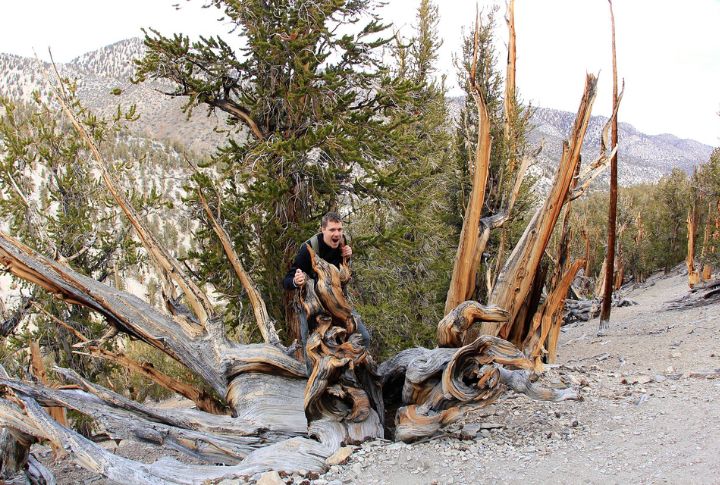
Bristlecone Pines Are Earth’s Oldest Trees
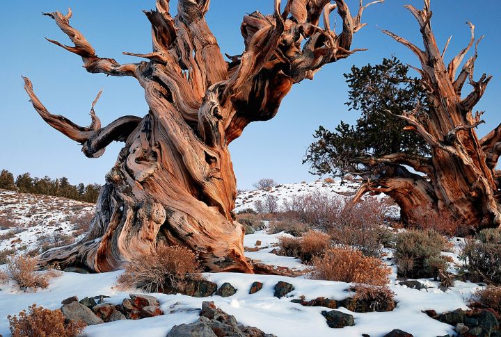
Clinging to the rocky slopes of California, Nevada, and Utah, bristlecone pines (Pinus longaeva) are Earth’s longest-living trees. Some individuals, like the famed “Methuselah” in California’s White Mountains, are over 4,800 years old. These trees defy time, growing slowly in high-elevation, wind-blasted soil.
Kentucky Bend Is An Exclave Surrounded By Missouri
Shaped by the Mississippi River and an 1812 earthquake, Kentucky Bend is an isolated pocket of land. It’s technically part of Kentucky but only accessible through Tennessee. Fewer than 20 people live there, and even GPS can’t explain how it ended up there.
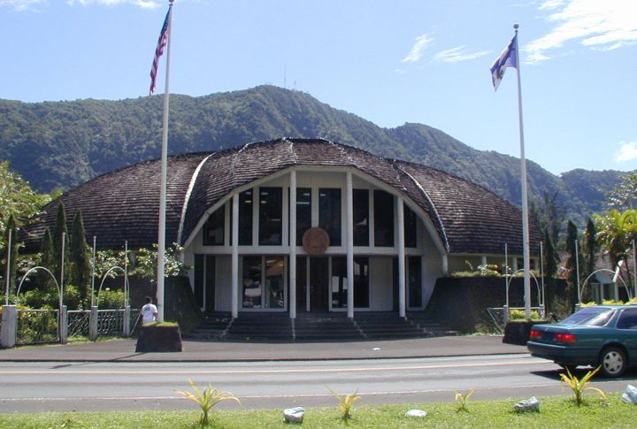
Hawaii Is The Only U.S. State Growing Coffee Commercially
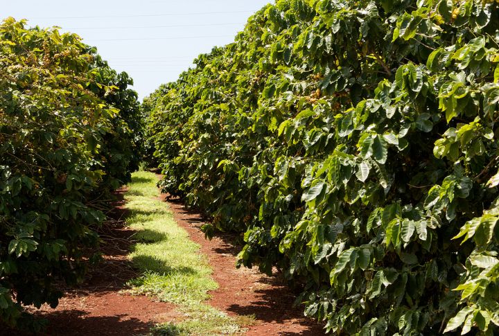
Thanks to its soil and tropical climate, Hawaii is America’s only state with commercial coffee farms. The Kona region on the Big Island produces world-famous beans. Elsewhere, cold snaps or frosts kill coffee plants before they bloom.
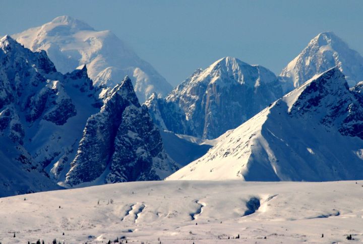
Mount Denali Acts As The Tallest Peak In North America
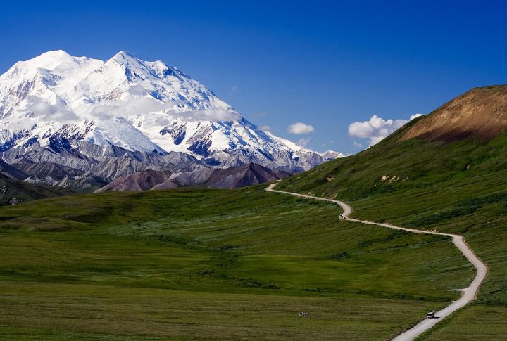
Denali, in Alaska, rises 20,310 feet—making it North America’s tallest mountain. Formerly called Mount McKinley, it towers so high it creates its own weather. Native Athabascans named it Denali, meaning “The High One.” Hence, it justifies the title.
The U.S. Has A Triple Divide Point In Montana
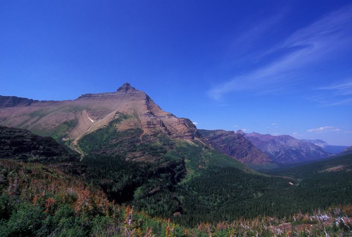
Triple Divide Peak in Glacier National Park splits water three ways. Rainfall there can drain into the Pacific, Atlantic, or Arctic Oceans. This hydrological oddity fascinates scientists and hikers alike. So, stand at its summit, and you literally decide where the water will travel.
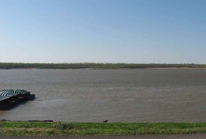
The U.S. Possesses The World’s Longest River System
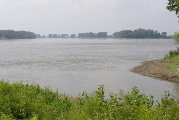
Combine the Mississippi and Missouri Rivers, and you get a hydrological superhighway. This river system once carried steamboats, rafts, and dreams westward. It carved canyons, nourished plains, and became the spine of frontier expansion. And today barges still hum along the same water that shaped a nation.
The Great Basin Has No Outlet To The Ocean
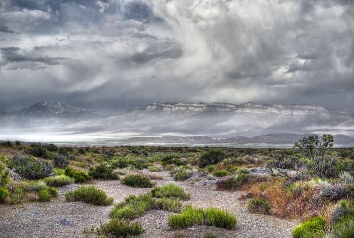
Stretching across Nevada and into five neighboring states, the Great Basin is an endorheic region—meaning no rivers or streams here reach the ocean. Hence, rainfall either evaporates or seeps underground. Plus, lakes like Pyramid and Great Salt are terminal, collecting minerals over centuries.
The U.S. Has Territories In Both Hemispheres
Most think of the U.S. as northern, but its reach dips below the equator. American Samoa, a South Pacific territory, lies entirely in the Southern Hemisphere. That gives the U.S. a geographical split, which is a kind of global ambidexterity with flags planted in both hemispheres.
The U.S. Contains A Number Of Lakes
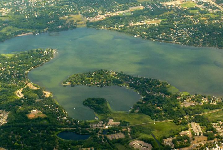
In the upper Midwest, lakes are so common that many lack names. Minnesota alone holds thousands, while Alaska has even more. Some lakes freeze year-round; others host summer fireworks shows. This diversity turns maps into a mosaic of shimmering blue.
One Can Walk From The U.S. To Russia
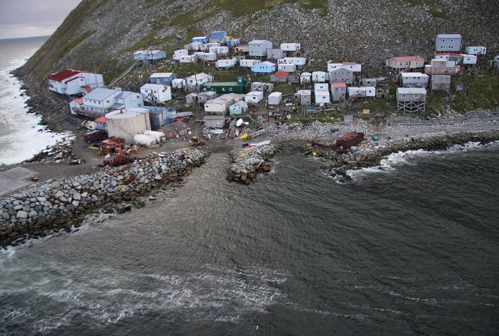
Only in winter can you technically walk from the United States to Russia—across the frozen Bering Strait. This is because two islands, Little Diomede (U.S.) and Big Diomede (Russia), sit just 2.4 miles apart. Hence, when the sea freezes, a daring trek across shifting ice becomes possible.
The U.S. Encompasses Diverse Climate Zones
There are only a few nations that can claim deserts, glaciers, rainforests, and tropics in one passport—America is one of them. Here, Arizona scorches while Alaska freezes and Wyoming gusts through high alpine plains. It’s a climatic buffet, and travelers never get the same dish twice.
Continental U.S. Experiences The Most Tornadoes Worldwide
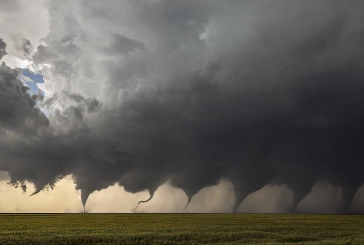
Tornado Alley slices through Texas, Oklahoma, and Kansas with fury. Each year, the U.S. sees over 1,200 tornadoes, which is more than any other country. This explosive weather stems from warm Gulf air colliding with chilly Rocky Mountain winds, creating the perfect storm.