Cities
Rising Waters Are Closing In On These 10 U.S. Cities
Rising sea levels are reshaping coastlines and communities, posing an escalating threat to numerous U.S. cities. Scientific projections highlight how increased flooding and coastal erosion could permanently alter urban environments. Here are 10 cities that face growing risks, demanding urgent attention to their vulnerable shorelines and infrastructure.
Miami, Florida
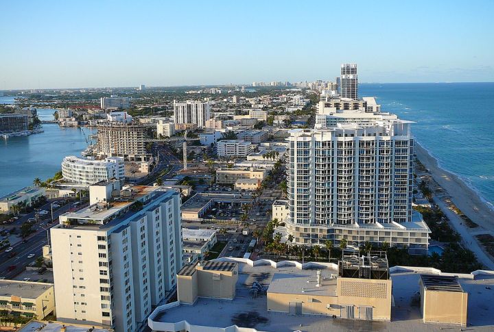
Miami’s low elevation and porous limestone bedrock make it especially vulnerable to rising seas. High tides, known as “king tides,” cause severe flooding, which disrupts daily life. Studies estimate that parts of Miami could see a two-foot sea level rise by 2060, threatening its $34 billion real estate market.
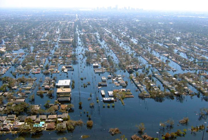
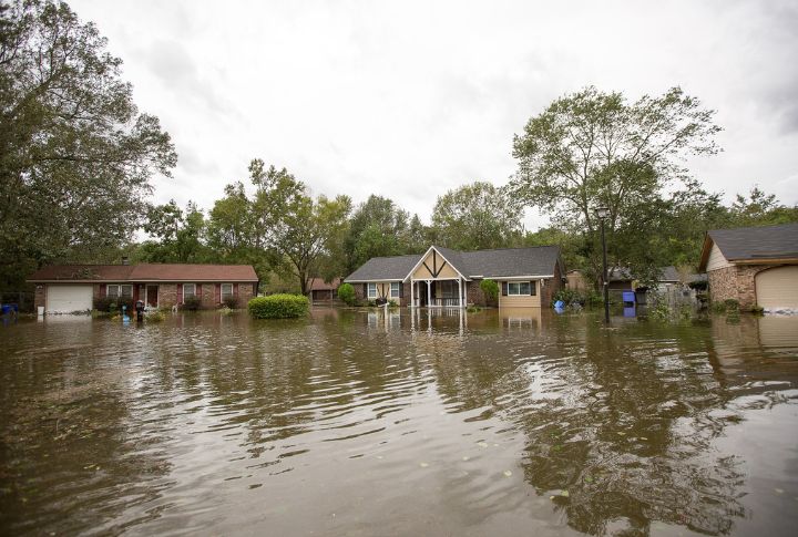
New Orleans, Louisiana
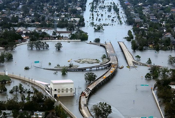
Recent reports warn that without major intervention, vast areas of New Orleans may be permanently inundated within decades. Built largely below sea level, the city depends on levees and pumps for flood protection. Climate change worsens its vulnerability, with land subsidence accelerating flood risks.
Norfolk, Virginia
Rapid land subsidence combined with rising sea levels ranks Norfolk among the most at-risk U.S. cities. Flooding increasingly disrupts the operations of its critical naval base. Experts warn that without significant mitigation, flooding could affect significant portions of the city by 2050.
Charleston, South Carolina
Projections indicate that by 2070, nearly half of Charleston’s land area could lie below average high tide levels. Frequent “nuisance floods” have become routine in Charleston and are damaging roads and buildings. Saltwater intrusion threatens the city’s freshwater supplies, compounding its vulnerability.
Boston, Massachusetts
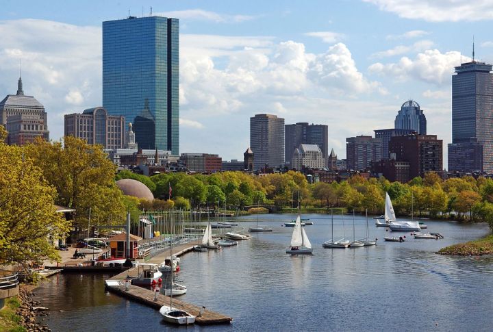
Coastal neighborhoods in Boston face growing exposure to storm surges and rising tides. Despite investments in flood defenses, future sea level rise may overwhelm current barriers. Approximately 10,000 residents live in zones projected to experience repeated flooding by the end of this century.
San Francisco, California
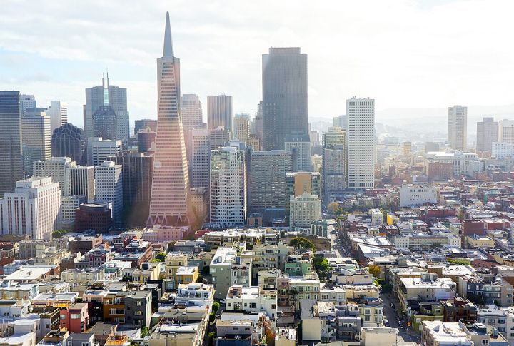
Parts of San Francisco’s eastern waterfront lie low enough to be regularly flooded as sea levels rise. Land subsidence worsens risks in areas housing key transportation hubs like ports and airports. To combat this, the city invests in seawalls, tidal barriers, and wetland restoration projects designed to absorb floodwaters.
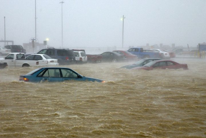
Galveston, Texas
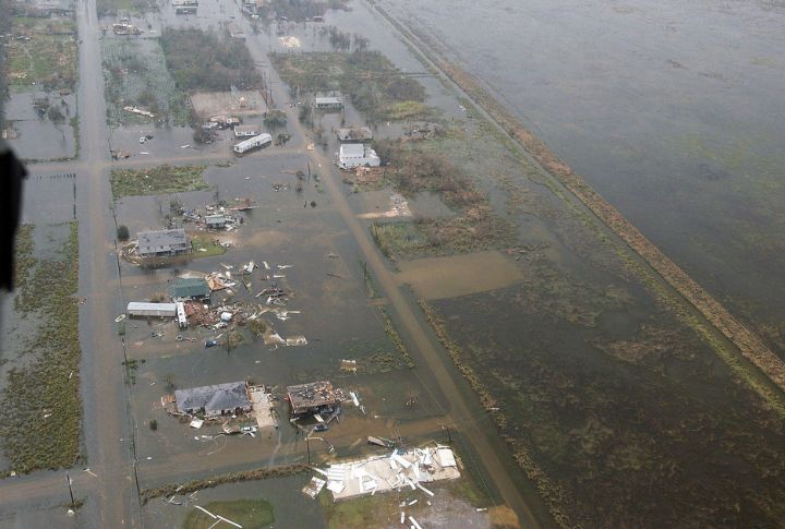
Galveston’s coastal defenses battle both rising seas and increasingly destructive hurricanes. Protective dunes and seawalls need constant upkeep to stave off flooding, but storm surges still breach barriers during major events. Nearly the entire island sits just a few feet above sea level, and FEMA designates vast sections as high-risk flood zones.
Providence, Rhode Island
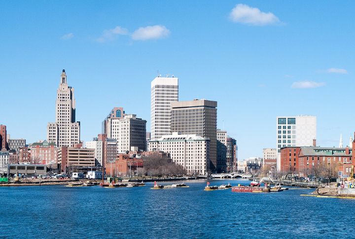
Tidal flooding has intensified around Providence’s Narragansett Bay shoreline, endangering historic districts and waterfront businesses. Rising sea levels are pushing floodwaters higher and further inland. Experts project that significant portions of the city’s shoreline could be chronically affected by flooding.
Virginia Beach, Virginia
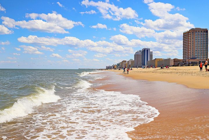
NOAA ranks Virginia Beach among the East Coast’s fastest-rising sea level zones, with over 30 square miles at risk of chronic inundation by 2060. Frequent flooding in Virginia Beach results from a combination of land subsidence and sea-level rise. Roads, homes, and military areas along the coast will be affected the most by 2075.
Houston, Texas
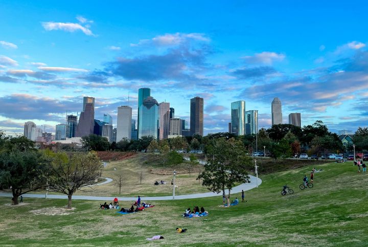
Houston’s sprawling urban footprint strains natural drainage systems, worsening flood risk as sea levels climb. Heavy rainfall and storm surge events increasingly impact its coastal neighborhoods. In response, local and state agencies have launched extensive flood control projects, including improved stormwater management and expanded detention basins.