Cities
10 Urban Freeways That Block Scenic Water Access In Major Cities
Waterfront cities are supposed to be relaxing. But thanks to certain highways, the only view you’re getting is bumper-to-bumper traffic. These massive roads slice straight through prime public spaces, turning scenic spots into car-infested barriers. Locals aren’t amused—and honestly, who can blame them? Let’s check out 10 urban freeways that really need to disappear.
I-5 In Seattle, WA
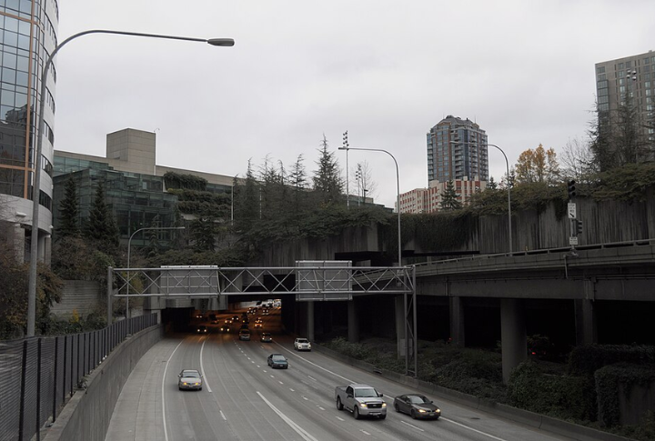
You’d never know Seattle has incredible mountain and water views because I-5 blocks most of them. The freeway slices between downtown and Puget Sound, bringing traffic and pollution from 100,000 cars a day. While the viaduct was removed and replaced with a tunnel, I-5’s elevated lanes through downtown still block access.
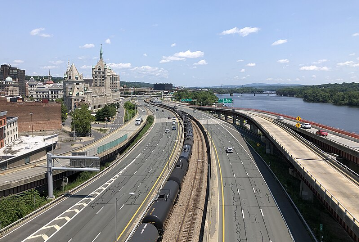
I-787 In Albany, NY
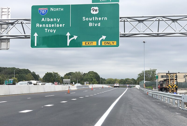
Albany’s riverfront has been trapped under I-787’s shadow, with 92 acres of potential locked behind concrete. Demolishing the highway would reconnect downtown to the Hudson, welcome back public access, and reveal long-lost mountain views. A redesigned boulevard would also be cheaper and more people-friendly.
I-95 In Philadelphia, PA
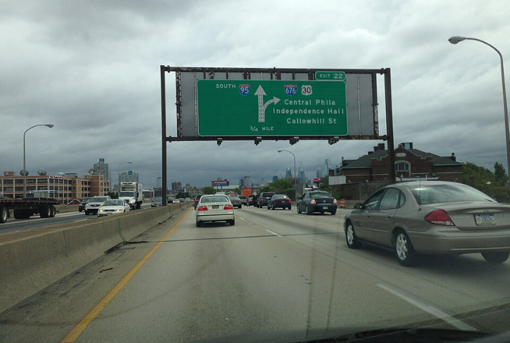
In Philadelphia, I-95 turns what should be a vibrant waterfront into a traffic corridor. This cuts off Old City from the Delaware River, hiding historic docks and iconic views of the Ben Franklin Bridge. With constant noise and pollution, the area loses its charm. Removing the freeway could reunite the city with its riverfront.
I-64 In Louisville, KY
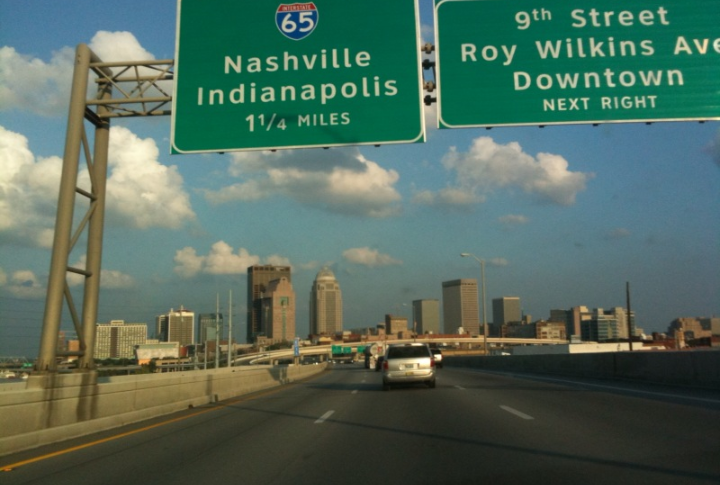
I-64 separates downtown Louisville from the Ohio River, blocks access, and limits potential. But with traffic down nearly 50%, there’s a real opportunity for change. The 8664 plan proposes replacing the freeway with a boulevard, making room for public parks and scenic views that could turn the area into a thriving destination and spark new investment.
I-70 In St. Louis, MO
The Gateway Arch stands tall, but I-70 runs right in front of it, cutting off downtown St. Louis from its most iconic feature. Instead of flowing into the riverfront, the city feels divided. Traffic noise replaces river sounds, and potential visitors miss out on what should be a stunning view.
I-10 In New Orleans, LA
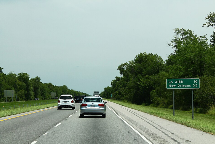
I-10 divides Treme from the Mississippi River, diminishing both its scenic beauty and historical significance. More than 80,000 cars use the freeway daily, bringing air pollution and hurting the neighborhood’s visual character. The presence of the elevated highway also weakens the area’s connection to the river.
I-35 In Austin, TX
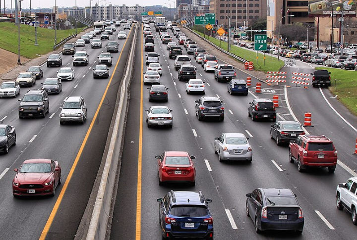
Have you ever tried catching a lake breeze near downtown Austin? Good luck. I-35 hogs the space and buries Lady Bird Lake behind a roar of 200,000 cars. East Austin barely gets a glimpse. Meanwhile, those famous sunsets by the Congress Bridge? Totally blocked. A tree-lined boulevard could finally give the lake back to the people.
I-81 In Syracuse, NY
I-81 slices through Syracuse, keeping the city and Onondaga Lake apart. Replacing it with a surface grid could bring slower traffic and better views. Temporary detours proved the streets could handle the change, so a full transformation could finally reconnect the city with its shoreline.
I-30 In Dallas, TX
The Trinity River once shaped Dallas’s identity, but I-30 now stands in the way. The elevated freeway blocks views and has displaced beloved oak trees that once shaded the banks. With fewer than 50,000 vehicles using it daily, it still limits the river’s full potential.
I-90 In Cleveland, OH
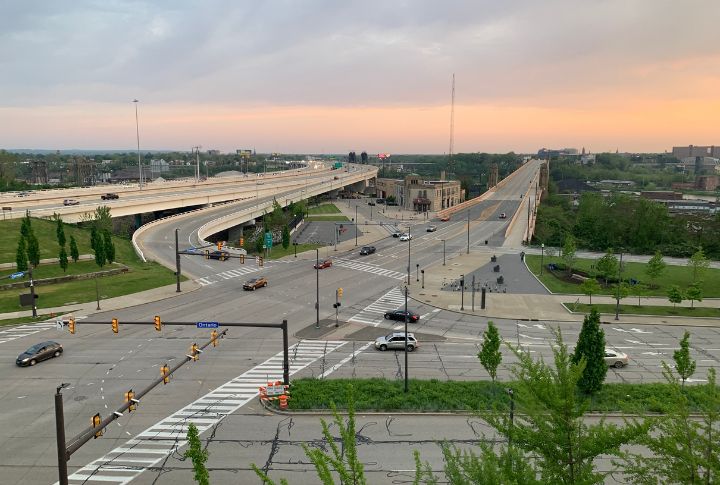
There was a time when Cleveland’s workers watched freighters sail into Lake Erie. Then came I-90. The highway silenced that story, cloaking the lake behind roaring traffic and towering ramps. With redevelopment inching forward, the question grows louder—how long will one road keep a great lake out of sight?