News
10 Earthquake-prone Areas In The U.S. To Watch

Seismic activity patterns don’t stay static for long, so the risks of earthquakes can increase anywhere in the world, including the United States. Here’s a clearer picture of the earthquake-prone areas in the U.S., drawing insights from the latest Geological Survey hazard model and tremor data, along with long-standing fault research.
Alaska
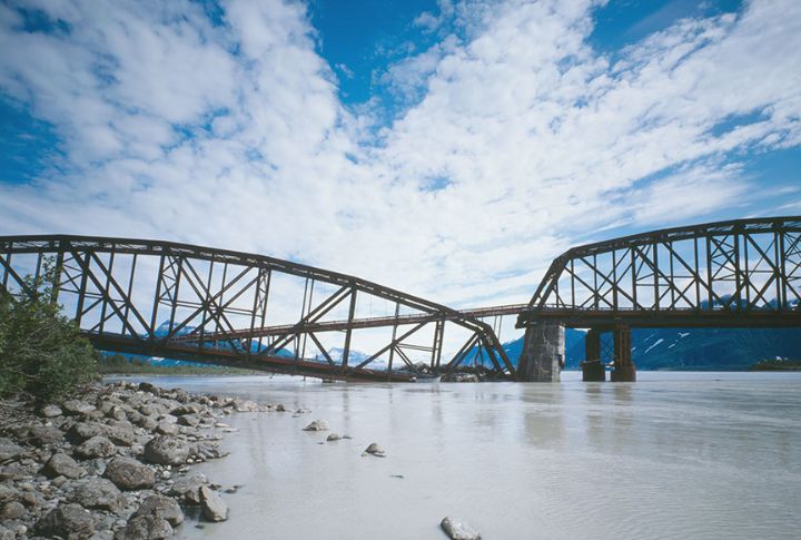
Nowhere else in the U.S. has experienced as many powerful earthquakes as this northern frontier, where the Alaska-Aleutian subduction zone drives near-constant seismic movement. Along the coast, tsunami hazards increase the overall danger. Strong shaking can also trigger liquefaction and landslides, especially in areas with unstable soils and steep terrain.
Southern California
Southern California rests on a network of major fault lines, including the San Andreas, San Jacinto, and Elsinore. Anchored by these major fault systems, the region faces a 93% chance of one or more magnitude 6.7 or greater earthquakes, according to the USGS forecast. Soft soils and outdated infrastructure further raise the region’s vulnerability.
Pacific Northwest (Oregon, Washington, Northern California)
Deep beneath the Pacific Northwest, the Cascadia Subduction Zone holds immense power. Its last rupture in 1700 triggered a tsunami that crossed the ocean to Japan. Scientists predict up to five minutes of violent shaking next time. Low-lying land may sink several feet, permanently reshaping coastal zones and emergency planning.
Hawaii
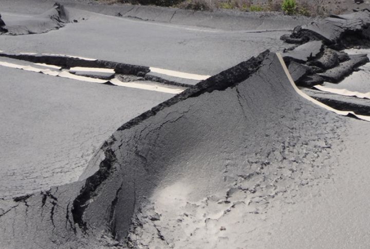
Frequent earthquakes in Hawaii are traced back to the islands’ dynamic volcanic systems, constantly changing the terrain. On the Big Island, the south flank shifts several inches each year, building strain that can be released without warning. That ongoing motion has triggered tsunamis and landslides and continues to set the stage for more.
New Madrid Seismic Zone (Missouri, Arkansas, Tennessee, Kentucky, Illinois, Indiana)
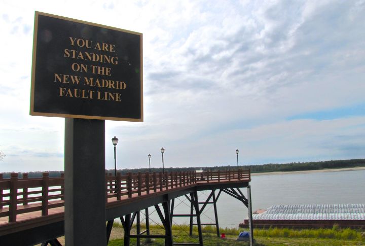
In the early 1800s, powerful earthquakes shook the central U.S., reversing rivers and forming lakes across the region. The New Madrid Seismic Zone remains active, with subtle shifts still recorded. Soft sediment beneath the area amplifies shaking, and experts estimate a 7–10% chance of a major quake within 50 years.
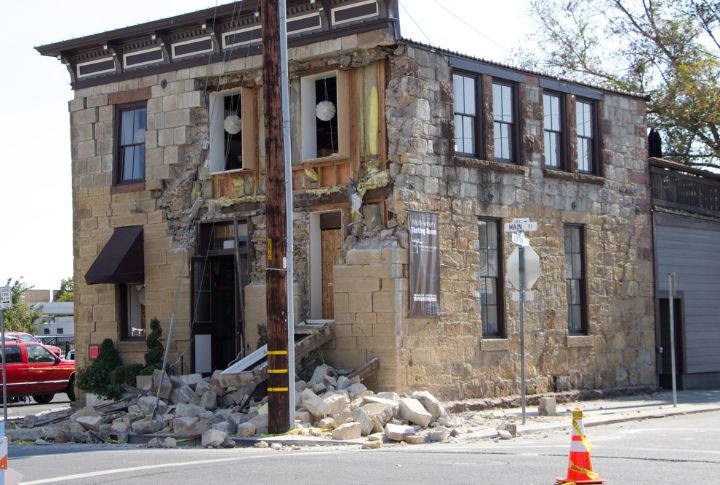
Atlantic Coastal Corridor (D.C., New York, Pennsylvania, Massachusetts)
In 1886, the Charleston earthquake became the most damaging in East Coast history, with tremors traveling across multiple states through dense crust. That deep reach is now getting fresh attention. The 2023 hazard model points to increased shaking potential along this corridor, where previously overlooked faults may pose a greater risk.
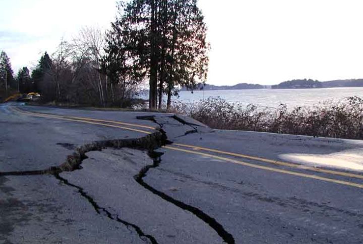
Wasatch Fault Zone (Utah)
Utah’s Wasatch Front ranks high on seismic risk maps, with a 57% chance of a magnitude 6+ earthquake in the next 50 years. Liquefaction from ancient lakebeds adds to the danger. Over the past 6,000 years, this fault has ruptured at least 20 times, though one segment has stayed quiet for centuries.
Oklahoma And Texas
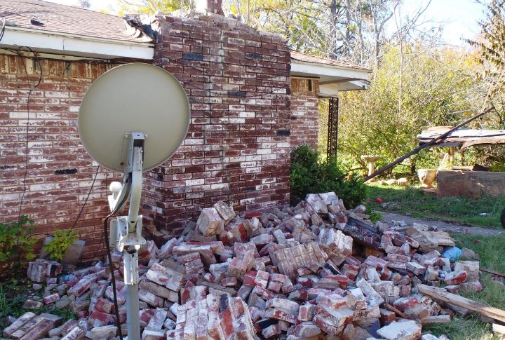
In the south-central U.S., earthquake rates have climbed sharply, mainly across Oklahoma and Texas. Between 2014 and 2017, Oklahoma recorded more magnitude 3+ quakes than California, a shift that caught national attention. Researchers attribute the increase to wastewater injection from oil and gas activity near fault zones.
Western Colorado And Rocky Mountains (Colorado, Wyoming, Montana)
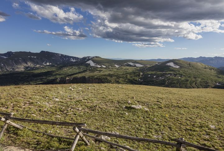
Fault lines beneath the Rocky Mountains don’t often make headlines, but seismic movement in western Colorado and nearby states has steadily drawn attention. More than 90 faults crisscross the region, including several capable of producing magnitude 7+ earthquakes. Areas like Glenwood Springs and the Front Range show increasing movement, prompting fresh concern.
Nevada
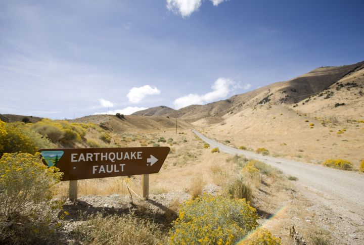
Nevada holds the third-highest earthquake activity in the country. Large quakes like Pleasant Valley in 1915 and Fairview Peak in 1954 show the scale of seismic force the region can produce. With Reno and Las Vegas close to active faults, ground failure and liquefaction remain key hazards, especially in areas seeing rapid development.